

Detecting Wildfire Damage with Python, Satellite Data & OSM - PT1
#30DayMapChallenge (15/30)

Detecting wildfire damage from space is an important and impactful use case for remote sensing and satellite data.
So, when I saw that Day 15 of the #30DayMapChallenge is themed Fire, I immediately decided to build a small geospatial pipeline to detect wildfire burn scars and assess property damage using geospatial data.
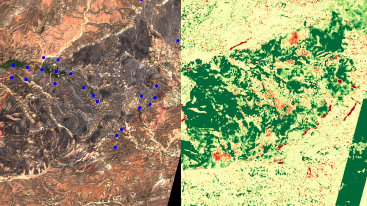
Using ESA Sentinel satellite data,…
